


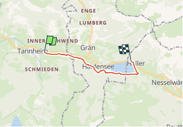
Bergbahn Neunerköpflé - Haldensee

patrickbeyrath
Utilisateur

Longueur
6,3 km

Altitude max
1162 m

Dénivelé positif
129 m
Km-Effort
7,9 km

Altitude min
1098 m

Dénivelé négatif
99 m
Boucle
Non
Date de création :
2024-04-29 05:36:28.468
Dernière modification :
2024-05-01 14:43:04.458
1h47
Difficulté : Facile

Application GPS de randonnée GRATUITE
 SityTrail
IGN / Instituts géographiques
SityTrail Plus
Le monde est à vous
À propos
Randonnée Marche de 6,3 km à découvrir à Tyrol, Bezirk Reutte, Gemeinde Tannheim. Cette randonnée est proposée par patrickbeyrath.
Localisation
Pays :
Autriche
Région :
Tyrol
Département/Province :
Bezirk Reutte
Commune :
Gemeinde Tannheim
Localité :
Unknown
Départ:(Dec)
Départ:(UTM)
614789 ; 5261721 (32T) N.
Commentaires